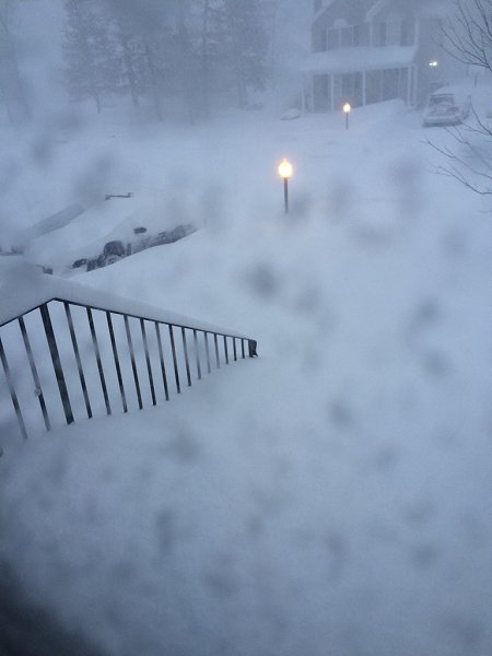
Millersville, Maryland
A special thanks to Dana Goodrich for the above photo
Snowfall Amounts:
Connecticut: Andover: 5.0”; Bridgeport: 1.3”; Danbury: 0.5”; Groton: 4.0”; Haddam: 4.0”; Hartford: 5.3”; Meriden: 3.0”; New Haven: 1.3”; New London: 3.0”; Norwich: 3.0”; Rocky Hill: 4.5”; Somers: 5.2”; Staffordville: 9.0”; Tolland: 8.5”; Vernon: 3.4”; Waterbury: 3.0”; Weston: 2.3”; and, Winsted: 5.0”
Delaware: Bear: 2.5”; Dover: 1.5”; New Castle: 1.4”; Newark: 2.0”; Port Penn: 1.4”; Wilmington: 2.1”; and, Woodside: 2.5”
District of Columbia: Washington: 0.1”
Maine: Andover: 1.5”; Aurora: 7.0”; Bangor: 3.5”; Bath: 2.0”; Belfast: 3.0”; Biddeford: 12.7”; Bridgton: 3.8”; Cape Neddick: 15.0”; Charlotte: 19.0”; Eastport: 23.2”; Eliot: 13.6”; Farmington: 2.0”; Gorham: 2.1”; Gray: 2.3”; Kennebunkport: 18.0”; Liberty: 2.0”; Lubec: 24.0”; Millinocket: 1.3”; Ogunquit: 17.0”; Old Orchard Beach: 15.0”; Poland: 2.2”; Portland: 2.3”; Robbinston: 25.4”; Roque Bluffs: 12.0”; Saco: 13.0”; South Portland: 4.0”; Turner: 1.5”; Whiting: 18.0”; York: 21.0”; and, York Beach: 24.0”
Maryland: Baltimore: 2.6”; Columbia: 4.0”; Damascus: 0.7”; Easton: 3.0"; Elkridge: 3.6”; Frostburg: 5.0”; Greensboro: 3.0"; Odenton: 2.4”; and, Towson: 1.5”
Massachusetts: Acton: 16.6”; Acushnet: 22.0”; Amherst: 4.2”; Andover: 12.5”; Arlington: 14.0”; Attleboro: 13.0”; Bedford: 15.5”; Boston: 16.2”; Bourne: 10.5”; Braintree: 13.5”; Bridgewater: 20.0”; Burlington: 14.3”; Carlisle: 14.5”; Centerville: 11.4”; Chemlsford: 13.8”; Cohasset: 13.4”; Concord: 13.3”; Dighton: 13.0”; Dracut: 13.8”; East Freetown: 18.5”; Fairhaven: 18.5”; Fall River: 17.2”; Foxboro: 15.6:; Framingham: 16.5”; Gloucester: 14.0”; Groton: 12.0”; Hanover: 14.0”; Hingham: 16.0”; Holbrook: 13.0”; Holliston: 12.0”; Hopkinton: 14.0”; Ipswich: 22.0”; Kingston: 16.5”; Lakeville: 15.0”; Lexington: 16.6”; Littleton: 14.1”; Lowell: 14.0”; Lunenburg: 14.6”; Lynn: 15.0”; Manchester: 15.0”; Mansfield: 17.0”; Methuen: 11.0”; Middleboro: 18.0”; Milford: 13.3”; Milton: 19.1”; Nahant: 13.2”; Nantucket: 9.0”; Natick: 14.7”; Needham Heights: 15.0”; New Bedford: 21.0”; North Chemsford: 12.5”; North Reading: 15.0”; North Weymouth: 15.0”; Norwood: 14.5”; Pembroke: 14.0”; Pepperell: 12.0”; Plymouth: 17.0”; Quincy: 16.0”; Randolph: 13.5”; Rockland: 13.5”; Salem: 17.0”; Salisbury: 20.5”; Sandwich: 12.0”; Scituate: 11.5”; Sharon: 20.0”; Shirley: 15.0”; Somerville: 15.5”; South Chelmsford: 13.0”; South Dartmouth: 22.8”; Stoughton: 13.0”; Stow: 15.0”; Taunton: 14.1”; Tewksbury: 15.0”; Topsfield: 13.5”; Townsend: 13.2”; Tyngsboro: 13.3”; Wakefield: 15.0”; Walpole: 15.4”; Ware: 7.0”; Wayland: 14.0”; West Acushnet: 17.5”; West Harwich: 12.0”; West Newton: 15.5”; West Wareham: 17.8”; Weston: 14.0”; Wilmington: 17.5”; Winchester: 15.2”; Woburn: 15.5”; Worcester: 10.1”; and, Wrentham: 12.1”
New Hampshire: Atkinson: 10.5”; Bedford: 10.0”; Berlin: 2.0”; Boscawen: 8.9”; Colebrook: 1.2” Concord: 9.7”; Epping: 7.0”; Greenland: 16.9”; Hudson: 10.6”; Keene: 7.9”; Laconia: 8.0”; Londonderry: 10.2”; Manchester: 8.5”; Merrimack: 8.5”; Milford: 9.0”; Nashua: 10.0”; Newport: 3.0”; North Hampton: 16.5”; Rindge: 14.0”; Stratham: 17.0”; and, Winchester: 9.0”
New Jersey: Atlantic City: 2.3”; Cape May: 3.0”; Colts Neck: 6.5”; Magnolia: 4.0”; Marlboro Township: 6.5”; Marlton: 4.5”; Neptune Township: 6.0”; Newark: 1.1”; Ocean Township: 6.0”; Pitman: 5.0”; Red Bank: 7.0”; Ridgewood: 0.7”; Roselle: 2.1”; Sussex: 3.0”; Toms River: 5.0”; Trenton: 4.5”; Vineland: 3.5”; West Milford: 3.5”; and, West Orange: 1.0”
New York: Albany: 5.9”; Amsterdam: 6.0”; Carmel: 1.3”; Clifton Park: 6.0”; Coram: 2.8”; Islip: 1.4”; Mattituck: 3.5”; Middle Grove: 7.6”; New York City: 0.9”; Newburgh: 1.0”; Orient: 5.5”; Patchogue: 2.0”; Poestenkill: 10.0”; Poughkeepsie: 2.0”; Shrub Oak: 1.8”; Troy: 6.5”; and, Yaphank: 1.8”
Pennsylvania: Bartonsville: 4.0”; East Stroudsburg: 2.0”; Furlong: 4.2”; Huffs Church: 1.8”; Mount Pocono: 4.0”; Philadelphia: 1.3”; Stormville: 4.3”; and, Whitemarsh: 3.0”
Rhode Island: Bristol: 9.0”; Burrillville: 13.0”; Natick: 16.8”; North Foster: 11.5”; North Providence: 12.2”; Portsmouth: 9.6”; Providence: 8.2”; South Kingstown: 9.0”; Warren: 14.0”; and, Westerly: 5.0”
Vermont: Burlington: 2.2”; Hartland: 3.5”; St. Johnsbury: 0.8”; Stowe: 2.3”; and, Woodstock: 3.0”
Virginia: Richmond: Trace; Sterling: 0.7”; and, Winchester: 0.5”
West Virginia: Bayard: 3.6”
News Account from Boston:
A storm brought a new round of wind-whipped snow to New England on Sunday [February 15], accompanied by near-whiteout conditions and lightning strikes in coastal areas as people contended with a fourth winter onslaught in less than a month…
Frank Libby, who was out trying to find newspapers in Boston Sunday morning, said it seems every few days the city is getting slammed with another foot of snow.
“It’s historic. It’s biblical,” the 62-year-old attorney said as he walked down a deserted street in the city’s Back Bay neighborhood. “I think we’re in uncharted territory. People just don’t know how to deal with the logistics of it.”
Source: Alanna Durkin and Michael Melia, “Latest in ‘biblical’ series of snowstorms slams New England, Associated Press, February 15, 2015.
Storm Description:
A WILD MORNING IN PROGRESS ACROSS EASTERN NEW ENGLAND AS LOW
PRESSURE IS BOMBING OUT AS IT MOVES NORTHEAST AND AWAY FROM THE
REGION. THE STORM STRENGTHENED IN TIME THOUGH FOR THE COLD CONVEYOR BELT TO SLAM EASTERN MA WITH 2 TO 4 INCHES OF SNOW PER HOUR THIS MORNING!
...DESPITE HEAVY SNOW ENDING BY AFTERNOON IN MOST LOCALES...WINDS ARE
ALREADY STARTING TO INCREASE. EXPECT NORTHWEST WIND GUSTS OF 35 TO
50 MPH ACROSS MOST OF THE REGION AND BETWEEN 55 AND 65 MPH ON THE
CAPE/ISLANDS. THIS WILL RESULT IN CONSIDERABLE BLOWING AND DRIFTING
SNOW THROUGH THE AFTERNOON. SOME OF THE DRIFTS MAY BLOCK
ROADWAYS...SO TRAVEL WILL REMAIN VERY DIFFICULT EVEN ONCE THE SNOW
STOPS! IN ADDITION...TEMPS WILL BE FALLING INTO THE SINGLE DIGITS
AND TEENS AS BITTERLY COLD [Air] WORKS INTO THE REGION. WIND CHILL VALUES WILL BE DROPPING TO BETWEEN 10 AND 20 BELOW ZERO BY LATE AFTERNOON!
Source: National Weather Service Forecast Office—Taunton, Forecast Discussion, February 15, 2015, 9 AM Update.
Quote:
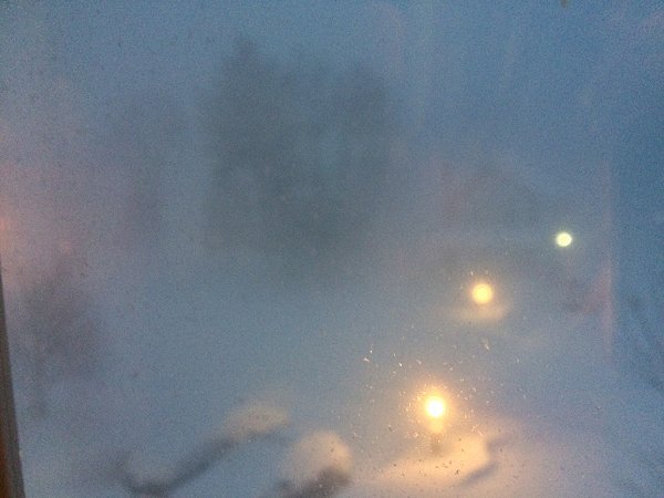
"Just woke up. What in the world is happening? I can't even see the house across the street!"
--SouthCoastMA, Acushnet, Massachusetts (February 15, 2015, 8:12 AM)